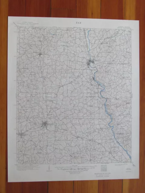
Opelika Alabama 1949 Original Vintage USGS Topo Map
$34.95 Buy It Now, $3.50 Shipping, 30-Day Returns, eBay Money Back Guarantee
Seller:  vintagetopo ✉️ (10,597) 100%,
Location: Dover, New Hampshire, US,
Ships to: US,
Item: 202390557126
Opelika Alabama 1949 Original Vintage USGS Topo Map.
Opelika Quadrangle Alabama- 30 Minute Series
Opelika Quadrangle Alabama- 30 Minute Series
Published by the United States Geological Survey
Year Published: 1949
Edition Year: 1909
Places: Huguley, Auburn, Lanett, Opelika, West Point, Valley, Smiths Station, Cusseta, Fredonia, Gabbettville, Lafayette, Whitesville, Salem, Bleecker, Shawmut
Water Bodies: Auburn Outing Club Lake, Avery Lake, Barksdale Lake, Beal Lake, Biggers Lake, Blackmon Lake, Bonita Farms Lake, Chambers County State Lake, Chatahospee Creek, Chattahoochee River, Chewacla Creek, Dickerson Lake, Edgar Lake, Flake Creek, Flat Shoal Creek, Flint Hill Lake, Floyds Lake, Halawakee Creek, Hamilton Lake, Hardley Creek, Harrell Lake, Hill Lake, Hills Lake, Jeff Beards Lake, Jones Lake, Jordan Company Lake, Kellem Hill Creek, Kilpatrick Lake, Lafayette Reservoir, Lake Harding, Lake Manderly, Lake Thel, Lake Walter Richards, Lake Williams, Lake Wilmore, Lanier Lake, Lee County Public Lake, Lees Lake, Little Chatahospee Creek, Little Sandy Creek, Little Uchee Creek, Long Cane Creek, Mountain Creek, Mulberry Creek, Neals Pond, Osanippa Creek, Oseligee Creek, Peterson Lake, Pine Lake, Pope Lake Number One, Riley Lake, Robinson Creek, Robinson Lake, Samford Lake Number One, Sandy Creek, Smiths Lake, Snake Creek, Sougahatchee Creek, Sougahatchee Lake, Standing Boy Creek, Taunton Lake, Thompson Lake, Wacoochee Creek, Webb Lake, West Point Lake, Wheeler Lake, Wildcat Creek, Wrights Lakes
Map may have red institutional rubber stamp and/or writing in the margin - please see the photograph. The map in the photo is the actual map you will receive. Map sheet measures approximately 17 X 21 inches.
All maps we sell are original USGS topographic maps, printed in the year stated in the title. We do not sell reproductions. Maps are shipped rolled up in a sturdy tube.
[10224]
- Publication Year: 1949
- US State: Alabama
- Original/Reproduction: Vintage Original
PicClick Insights - Opelika Alabama 1949 Original Vintage USGS Topo Map PicClick Exclusive
- Popularity - 8 watchers, 0.0 new watchers per day, 2,084 days for sale on eBay. Super high amount watching. 0 sold, 1 available.
- Best Price -
- Seller - 10,597+ items sold. 0% negative feedback. Top-Rated Plus! Top-Rated Seller, 30-day return policy, ships in 1 business day with tracking.
People Also Loved PicClick Exclusive

Opelika Alabama 1949 Original Vintage USGS Topo Map
$34.95 Buy It Now 16d 8h
Grove Oak Alabama 1949 Original Vintage USGS Topo Map
$34.95 Buy It Now 2d 14h
Manchester Michigan 1949 Original Vintage USGS Topo Map
$34.95 Buy It Now 20d 9h
Charlotte Michigan 1949 Original Vintage USGS Topo Map
$34.95 Buy It Now 12d 10h
Barker New York 1949 Original Vintage USGS Topo Map
$34.95 Buy It Now 7d 12h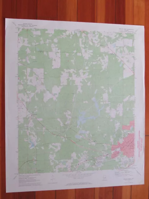 1 watcher
 Opelika West Alabama 1973 Original Vintage USGS Topo Map$34.95 Buy It Now
 Opelika East Alabama 1973 Original Vintage USGS Topo Map$34.95 Buy It Now
 1 watcher
USGS Topographic Map OPELIKA Alabama Georgia 1981 1982 -100K-
$19.95$16.96 Buy It Now
