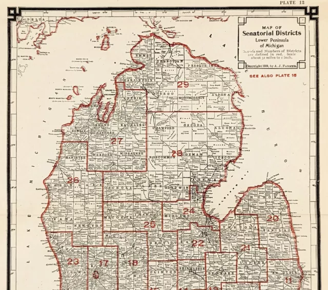
Set of 19 Maps of Michigan Districts 1905 Great condition Upper Lower Peninsula
$79.95 Buy It Now or Best Offer, $14.95 Shipping, 14-Day Returns, eBay Money Back Guarantee
Seller: historypaper ✉️ (3,983) 99.5%,
Location: Crete, Illinois, US,
Ships to: US, BM, CA, GL, MX,
Item: 226038632046
Set of 19 Maps of Michigan Districts 1905 Great condition Upper Lower Peninsula. Explore the beauty of Michigan with this set of 19 antique and vintage maps featuring the state's districts. The maps showcase the unique features of the Upper and Lower Peninsula, including important landmarks and geographical locations. Published in 1914, these original maps offer a glimpse into the past and are perfect for collectors and history enthusiasts.
Ideal for display or reference, this world atlas type collection is formatted as atlas maps and features North America's Michigan state. The maps were produced between 1910-1919 and offer a glimpse into Michigan's rich history. The set is perfect for those looking for unique and rare additions to their collection of North America maps, atlases, and globes.
- Original/Reproduction: Original
- Format: Atlas Map
- Features: Antique,Vintage
- Publication Year: 1914
- Continent: North America
- Type: World Atlas
- North America States & Provinces: Michigan
- Year: 1914
- US State: Michigan
- Date Range: 1910-1919
PicClick Insights - Set of 19 Maps of Michigan Districts 1905 Great condition Upper Lower Peninsula PicClick Exclusive
- Popularity - 1 watcher, 0.0 new watchers per day, 38 days for sale on eBay. Normal amount watching. 0 sold, 1 available.
- Best Price -
- Seller - 3,983+ items sold. 0.5% negative feedback. Great seller with very good positive feedback and over 50 ratings.
People Also Loved PicClick Exclusive

1810 Nice Original Map Texas California United States Florida Canada Hawaii
$49.00 Buy It Now 23d 6h
Vintage Antique 1861 Illinois Map W/ Plan Of Chicago Inset Nice Size
$100.00 Buy It Now 27d 1h
Antique Geological Survey Michigan 1911 Upper Lower Peninsula Color Maps
$29.99 1 Bid 1d 0h
1905 Upper Peninsula Michigan Map Counties Marquette Houghton Kalamazoo Allegan
$49.00 Buy It Now 28d 9h
1905 UPPER PENINSULA Map ORIGINAL Michigan Menominee Isle Royale Dickinson
$49.00 Buy It Now 28d 9h
1905 MICHIGAN Map ORIGINAL Political Districts Townships Counties Railroads
$39.88 Buy It Now or Best Offer
MICHIGAN COUNTY Map 1909 ORIGINAL Townships Railroads Political Districts Ingham
$45.00 Buy It Now
1909 Michigan Map Senatorial Districts County Townships Railroads Grand Traverse
$59.88 Buy It Now or Best Offer
 Michigan 1873 Maps Congressional Senatorial Representative Districts Judicial$19.50 Buy It Now or Best Offer


