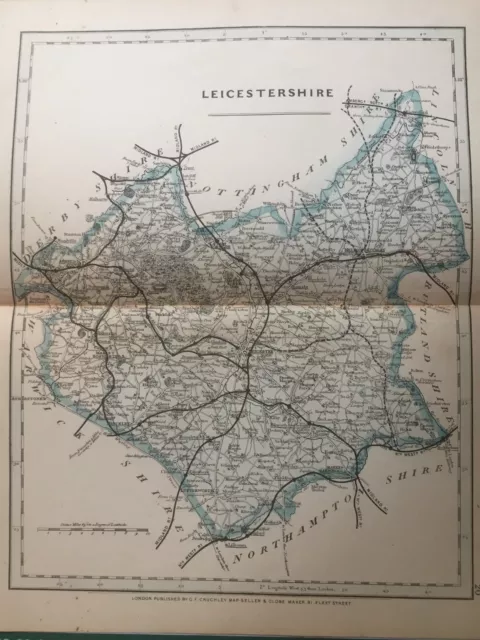
1875 Antique Map; Cary / Cruchley map of Leicestershire. Orig Outline Colour
On offer is an original (i.e. not a later reproduction) 1875 map of "Leicestershire". The map has early outline colour.
DATE PRINTED: 1875
SIZE: The printed area including titles is approx. 10.75" x 8.5" (27.5 cm x 22 cm) with a centre fold as issued.
ARTIST/CARTOGRAPHER/ENGRAVER: Drawn by John Cary, original in 1787 (see more detailed notes on the history lower down).
PROVENANCE: A plate published in "Cruchley's County Atlas of England & Wales ".
TYPE: Antique lithograph printed on paper.
VERSO: There is nothing printed on the reverse side, which is blank.
CONDITION: Very good. Suitable for framing. Please check the scan for any blemishes prior to making your purchase. Virtually all antiquarian maps and prints are subject to some normal aging due to use and time which is not significant unless otherwise stated.
AUTHENTICITY: This is an authentic antique print, published at the date stated above. I do not offer reproductions. It is not a modern copy. The term 'original' when applied to a print means that it was printed at the first or original date of publication; it does not imply that the item is unique.
RETURNS POLICY: I offer a no questions returns policy. All I ask is that you pay return shipping and mail back to me in original condition.
BACKGROUND INFORMATION : John Cary’s New and Correct English Atlas first appeared in 1787 but by 1809 the plates had been used so worn that new, nearly identical, plates needed to be engraved. These were used upto a final issue in 1843. In 1844 George Cruchley purchased G. and C. Cary's stock of printing plates, and set about changing the titles and imprints to continue their usage. Whereas the Carys had used intaglio printing, Cruchley turned to the fast growing method of printing by lithographic transfer, which offered greater flexibility in making quick changes. The atlas placed great stress upon the inclusion of railways and stations, as to be seen to be keeping pace with the fast growing national railway network was a marketing necessity. In 1877, Gall and Inglis, the Edinburgh cartographers, bought out Cruchley’s maps and produced them under his name, then under their own. Therefore the 1875 edition was the final Cruchley publication from the old Cary plates.Please explore my ebay shop for more antique prints.
Track Page Views With Auctiva's FREE Counter- Condition: Very good. Suitable for framing. Please check the scan for any blemishes prior to making your purchase. Virtually all antiquarian maps and prints are subject to some normal aging due to use and time which is not significant unless otherwise stated.
- Type: County Map
- Date Range: 1800-1899
- Year: 1875
- Country/Region: England
- County: Leicestershire
- Printing Technique: Lithography
- Era: 1800s
- Original/Reproduction: Antique Original
- Format: Atlas Map
- Cartographer/Publisher: George Cruchley
PicClick Insights - 1875 Antique Map; Cary / Cruchley map of Leicestershire. Orig Outline Colour PicClick Exclusive
- Popularity - 0 watchers, 0.0 new watchers per day, 2,215 days for sale on eBay. 0 sold, 1 available.
- Best Price -
- Seller - 12,678+ items sold. 0% negative feedback. Great seller with very good positive feedback and over 50 ratings.
People Also Loved PicClick Exclusive

1875 Antique Map; Cary / Cruchley map of Suffolk. Orig Outline Colour
$16.17 Buy It Now 8d 7h
1875 Antique Map; Cary / Cruchley map of Buckinghamshire. Orig Outline Colour
$16.17 Buy It Now 8d 7h
1875 Antique Map; Cary / Cruchley map of Durham. Orig Outline Colour
$16.17 Buy It Now 8d 3h
1875 Antique Map; Cary / Cruchley map of Staffordshire. Orig Outline Colour
$16.17 Buy It Now 8d 7h
1875 Antique Map; Cary / Cruchley map of Essex. Orig Outline Colour
$16.17 Buy It Now 8d 3h
Cruchley's (Late Cary's) reduction of his large six sheet map of the British Isl
$258.66 Buy It Now or Best Offer
1787 John Cary Antique map of Lancashire, England with text page
$76.99 Buy It Now
Western Hemisphere, Historic Map by Cary 1799
$39.99 Buy It Now
